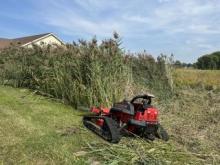
Several tribes in Wisconsin are making progress removing invasive plant species through this USDA Forest Service Eastern Region grant.
March 22, 2024
March 22, 2024
Several tribes in Wisconsin are making progress removing invasive plant species through this USDA Forest Service Eastern Region grant.