On this page:
Objective, Commitments & Measures
Objective:
3.3. Improve effectiveness of nonpoint source control efforts to prevent harmful and nuisance algal blooms.
Commitments:
3.3.a. Monitor and assess nutrient conditions in western Lake Erie, Green Bay, Saginaw Bay and priority tributaries to the Great Lakes.
3.3.b. Demonstrate new, improved or collaborative approaches to achieve water quality goals.
Measures:
| Measures of Progress With Annual Targets | Baseline/ Universe | FY2025 Target | FY2026 Target | FY2027 Target | FY2028 Target | FY2029 Target |
|---|---|---|---|---|---|---|
| 3.3.1. Nutrient monitoring and assessment activities conducted. | 30/N/A | 30 | 30 | 30 | 30 | 30 |
| 3.3.2. Nutrient and stormwater runoff reduction demonstration projects implemented. | 10/N/A | 10 | 10 | 10 | 10 | 10 |
"Targets" are not cumulative. "Baseline" and "Targets" for Measure 3.3.1 and 3.3.2 identify activities conducted annually.
Background
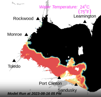
GLRI has supported the deployment of state-of-the-art technologies to predict and understand the environmental drivers of HABs. Scientists use an integrated approach consisting of satellite images, real-time buoys and a comprehensive monitoring program to predict algal bloom intensity and movement in western Lake Erie. HABs are tracked in real time, and weekly bulletins are issued that report the HAB’s current location, forecast its future movement and categorize its intensity. Bulletins are available online, allowing decision-makers, coastal community residents and visitors alike to better monitor and plan around the presence of HABs. Modeled after Lake Erie, similar approaches are being piloted in Saginaw Bay and Green Bay. GLRI has also supported the development of Runoff Risk forecasts, which incorporate weather forecasts with soil moisture models to help farmers decide when to apply nutrients, based on where and when there is a likelihood of surface water runoff.
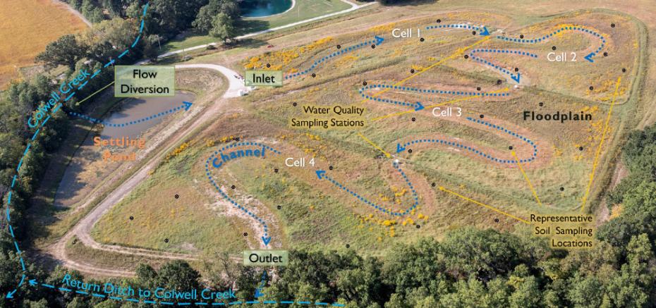
GLRI federal agencies and partners have conducted 30 monitoring and assessment activities ongoing each year to examine nutrient sources and impacts. In addition, 10-15 multiyear projects were launched to evaluate approaches to manage runoff at the watershed and field scales and pilot new technologies. Research to date has provided valuable insights, including that performance of individual practices is highly variable and implementing systems of conservation practices (nutrient management, cover crops and drainage management) in specific priority areas will have the greatest impact on preventing nutrient losses from farms. The information learned from these studies will help improve future project designs so that water quality benefits are maximized.
Under GLRI Action Plan IV, GLRI federal agencies and partners will continue to:
- Test or pilot new/innovative ways to achieve nutrient reductions, such as slow-release fertilizer and manure transformation technologies.
- Assess the potential for wetlands to act as sinks for nutrients, and quantifying phosphorus load reductions based on actual performance.
- Monitor and assess nutrient levels in the major tributaries to the Great Lakes and nearshore areas experiencing algal blooms.
Continue reading about the Action Plan IV:


