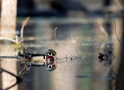
Shiawassee National Wildlife Refuge has undergone a dramatic transformation over the past decade, thanks to funding from the GLRI. Habitat restorations have reconnected rivers that were cut off from diked floodplains for more than 100 years. The refuge is the site of a 1,000-acre wetland restoration project, which aims to provide high-quality habitat for wildlife and cleaner water.
“We have worked hard to prove this is a coastal system,” said Eric Dunton, a U.S. Fish and Wildlife Service refuge biologist for the past 13 years. “Despite being 20 miles in-land, the Shiawassee Flats are directly connected to Saginaw Bay and the southern end of Lake Huron.”
Michigan’s lower peninsula is famously mitten-shaped, thanks to Saginaw Bay. Twenty miles south of the bay lies the refuge’s impressive 10,000-acre grassland and wetland complex. That complex is part of a larger area called the Shiawassee Flats, which act like a giant funnel where the Cass, Tittabawassee, Shiawassee, and Flint rivers all converge in this low-lying area.
The flats include the national wildlife refuge, the state game refuge, and surrounding wetland complexes. They serve as an important migratory stopover for tens of thousands of waterbirds. Fish, amphibians and other wildlife also rely on the habitat for breeding grounds, and the area is well known as a recreational paradise for bird watchers, anglers and hunters.
Dunton has been working with partners to assist in surveys to better understand the fisheries population of the Saginaw River. U.S. Fish and Wildlife Service, the U.S. Geological Survey, and the University of Michigan School of Natural Resources and Environment have partnered to determine how many fish are in the river and are moving into the refuge. Using sonar detection, the partners have been able to see how many fish are passing through the system. This allows scientists to better understand how aquatic species use the coastal marsh, which is critical to understanding the next steps in the refuge restoration.


